Tales of the Dempster Hwy & Inuvik to Tuktoyaktuk Hwy!

Days before we arrived at the beginning of the Dempster Hwy and the Inuvik to Tuktoyaktuk Hwy (ITH), people warned us about them. Oooohhhh! Watch out! Have 3 spare tires! Get ready to have your windshield broken! But don’t get it fixed as you will have it broken again! Etc…….

Turns out it was one of the most awesome drives ever! But…..
Here is what we actually saw; sorry there are not pics of everything due to the heat of the moment.

We came upon a burning road crew truck on the ITH. We grabbed our fire extinguisher and helped put it out. The guys were very appreciative They set us up with a couple of extra extinguishers when we returned to Inuvik and a promise that if we ran into trouble on the trip south to call them and they would rescue us.

The Heroic Fire Brigade!
I was driving, so I monitored the situation from afar with my carrot stogie.

Too many broken windshields to count. We think it was a local badge of honor as the locals fly up and down the road. One local told us the next section of road was an hour drive…it too us two and a half!

Tire carcasses and blow outs due to the rocks that make up the roads.

One broken axle on a trailer.

One bent wheel on a jeep.

One wheel popped off a very large delivery truck. And another large truck driving with a shredded tire.

Campers that now squeak and are definitely going to need some repair work.

Very large gravel trucks. They are still putting fine touches on the ITH, it just opened a few months ago, and the gravel trucks run constantly.

Several landslides. Unaware to us a large landslide closed the road behind us as we traveled north. The road was still being cleared when we were coming south and the river below it had had a new island!

A large landslide that closd the risd behind us for 2 days. They were still cleaning it up when we came back down.

Rain closing the road. The road to Tuk was closed for 3 days just prior to our arrival in Inuvik. The “weather window” is a common topic of discussion as you travel north as it can change the road conditions drastically. We were lucky enough to have a beautiful day for our drive from Inuvik to Tuktoyaktuk.
The Bugs! Some days there were none and others were beyond description!

The Dust! I think it will take many showers for us and the Rover to be clean again.

Black Mud. The road is made from whatever stone or rock is nearby, in the case of black mud the road is made from ground up oil shale. When it gets wet, it is mud lubricated with oil.
On our way south, we came upon a truck & camper playing a game of chicken on the Dempster in the infamous Black Mud. The truck lost when it pulled over to let the camper pass. We pulled to the side a bit to get out of the campers way and proceeded to begin sliding sideways off the road. We popped the rover into 4WD and tried to back into the center of the road. We slid closer to the edge and a potential roll over (the road is built high above the permafrost), we then dropped it into low range and the wee Rover crawled her way back to the packed center of the road. We were unable to help the other truck but we were lucky to flag down a road crew who very nicely brought a road grader to pull the truck back onto the road.

We had snow, hail, fog like pea soup, rain, 24 hours of sun, dust that coated the inside of the rover, mud that coated the outside of the rover, a road rough enough that we may have loosened a few fillings, a road smooth enough that it felt like pavement, skies so clear you could see forever, and views that humbled the soul!

Constantly changing weather and road conditions.
After we came over the Richardson Pass in thick fog, a rainbow came out.

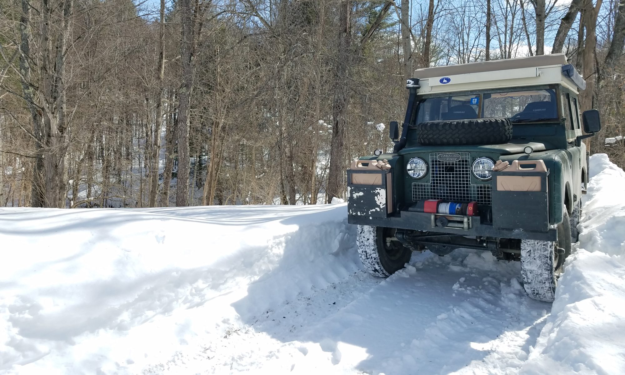
We drove slow and had no flat tires, no cracked windows and the wee Rover out did herself!
 

The Dempster Highway

The Dempster Highway is a 450 mile out and back gravel road from the Yukon, past the Arctic Circle to Inuvik in the Northwest Territory (550 miles if you travel the new extension to Tuktoyaktuk for a total round trip of 1100 miles). It crosses different landscapes and climates. It climbs over the continental divide (3 times each way) and sinks all the way down to sea level. The weather can change in an instant and thus the road conditions. It is an amazing journey that should be on everyone’s bucket list and cannot not be described in words…so we will use pictures over the next few blog posts to give you a glimpse.

And we’re off!
550 miles of gravel road to Tuktoyaktuk and the Arctic Ocean.
Tombstone Mts
Ogilvie Mts. Looked like the moon.
Ogilvie Mts
Storms sneaking up behind us. The weather can drastically change the road conditions.
Ferry across the MacKenzie River!
Gravel pits are everywhere from building the road (they used whatever materials were close by). They made great free campsites! Zoom in to see the wee Rover!
Aedan is hiking the Trans Canada Trail. He has been out for a year and a half and figures he is halfway done. Amazing young man.
Everything is built on permafrost which can make for some amazing mud!


Do Bears Shit in the Woods?

Well, I think they probably do, but…they also shit on paved roads, gravel roads, dirt roads…well any kind of road.

What is up with that?

Now that is some fresh bear road shit! We looked , but didn’t see the bear. I made Darrin take that picture!

Yukon Territory Campgrounds

The Yukon has amazing campgrounds!

Think state campgrounds in the US, but way better. The campgrounds are $12 CAD or about $9 USD, are lightly used, are in beautiful places, are quiet, and provide free firewood. We are in love! We could have spent a month here, at least!

Little Salmon Lake
Little Salmon Lake 2
Frances Lake
Free wood and clean pit toilets.
Even a kitchen cabin with a huge woodstove!

Campbell Hwy (aka really long dirt road)

We are in the Yukon!

How cool is that…and no we haven’t seen Yukon Cornelius, yet. We will be on the look-out!

We left the Stewart-Cassier Highway and got onto the Alaskan Highway for exactly 14 miles. We can now say we have been on the Alaskan Highway…too many RVs and trucks for our Rig and our style.

We turned off in Watson Lake and headed into town for provisions and information on the wildfire that was burning near the Robert Campbell Highway(highway up here is a very loose term), our intended route. A quick stop at the visitor’s center where the sign post thingee is from when they built the Alaskan Highway, cool but not quite our taste, and the grocery store and we were off. The wildfire was still west of our route and although there were smoke advisories, and some evacuations we were cleared to head north.

The Robert Campbell Highway started off paved, quickly turned to hard pack and then to gravel. Once again, we were reminded of the Maine logging parcels we drive on back home to go canoeing, long dirt roads surrounded by pines. The only difference was the huge swaths of burnt areas from previous wildfires, they were a little unsettling. Wildfires up here are just part of life. No one seems upset. They keep the forest regenerating. We have now gotten used to seein huge swaths of burnt trees.

During the 370 km (that’s about 230 miles for those in the States) we traveled, we saw more bears than vehicles. That would be 4 black bears, a lynx, a really cool black and brown fox and a momma grizzly with her cub (and yes, we only saw 3 pick-ups the whole way in). Oh, and we saw a few flurries. Good thing we packed warm gear.

About halfway , we stayed 2 nights in a Yukon Provincial campground on Frances Lake, I know we splurged and spent $12 CAD a night. It is absolutely beautiful and peaceful. We thought we would be the only ones there, due to the low volume of traffic, all going the other way, but surprise, surprise there were about 12 other campers already there (there are only 24 sites).

We made it!
Forest fire ahead of us.
Smoke blowing across the road.
And looking back.
1 of 2 lynx we saw. They have huge feet!
The wee Rover got a bit dirty!

The Stewart-Cassier Highway (Rt 37)

The Stewart-Cassier Highway (Rt 37)
As we thought about driving to Alaska (the first thing was…holy crap…we are driving to Alaska!) the question of which route came up. We were sitting in the ‘Sound of Music Meadow’ dispersed campsite (an amazing little spot way up in the hills) in Montana pouring over the maps. The AlCan (Alaskan Highway) would have been the obvious choice. But wait, what’s this little route over to the west? Route 37? The Stewart-Cassier Highway? Never heard of it, lightly used, long stretches through the mountains, perfect!

As soon as we hit The Stewart-Cassier it felt right. We found a little city park and several BC campgrounds (all free). Glaciers, the mountains, the great bear scare!, more mountains, more glaciers, wolves, bears, lynx, totems, no traffic, no guardrails, no cell service, 470 miles of awesome!

We did end up hitting the AlCan; all of 14 miles from Rt. 37 to Watson Lake!

The start…we’re off!
The nitty gritty
Traditional totems
Bear Glacier
Mountains, mountains and more mountains!
And gorgeous lakes!
And beautiful rivers!
And tons of wildlife, most of which disappears so fast you can’t get a picture.


Bear Lake

It was a cold and rainy afternoon when two road weary travelers rolled into Stewart, British Columbia in search of a place to rest their tired bones. The only campground in town was closed, for renovations, not to open until the following year. The exhausted travelers stumbled into the local tourist office seeking advice from the local elder. She shook her head and in a quiet voice told them the legend of the phantom bear of Clements Lake. She pointed her gnarled finger up the street at the local motel and told them they better bunk in for the night.

The travelers emptied their pockets and counted their pennies, not enough. The old woman looked down at the floor silently contemplating. She knew the owner of the motel to be a hard person who would not take pity or offer a handout. She slowly raised her eyes and gave the travelers directions to Clements Lake. Thanking her the travelers took a deep a breath and left as the old woman chanted a blessing.

Climbing into their old rig and heading north out of town the travelers found the turn off for Clements Lake. The sign hung askew on a rusted metal post, the road showed very little traffic. Easing onto the rutted lane they inched their way up to the lake. It was a beautiful place, a small lake with mountain waterfalls crashing down in the distance. Could this be the place of legend? The peaceful surroundings were in stark contrast with the old woman’s story. Was she playing a local trick?

Picking a site, there were only 2, the travelers set up their rig and jumped in the cold lake to wash off the road dust. They had just finished, thank goodness, when in drives an RCMP vehicle. The ranger rolled down his window and wanted to know if they had seen a crazed grizzly. The travelers having decided this was all a joke shook their heads laughing. Giving the travelers a funny look, the ranger told them an aggressive grizzly was charging log trucks on the main road and to ‘keep an eye out’, oh and cool Rover. He then spun his SUV around and spit rocks as he raced out of the park.

Totally confused at this point, the travelers settled in for an uneasy night.

Sweet dreams!

We later learned the lake is known as Bear Lake by the locals for the number of Grizzlies that hang around that area.

We are heading up the Dempster Highway into the Northwest Territory and to the North Sea, to put our toes in the water. We will probably be out of touch for 10 days or more.

Happy trails everyone!


Fresh Fish Fry

Yesterday, we traveled miles and miles across land that looked just like northern Maine paper company land. We passed more wood trucks than I could count (logs, boards, sawdust, and every other type of wood imaginable) and trains carrying the same. The British Columbia wood industry is Maine on steroids.

Last nightwe found a small British Columbia recreation area, Cobb Lake. BC has these recreation areas everywhere. A local told us to go to the ones with small signs because they are usually free, the ones with big signs cost $$$, great tip! Our neighbors were there for the week fishing. We met them while looking for the pit toilets (and got the lowdown on which ones not to use, always good to know). They had just caught a bunch of lake trout and invited us over for dinner (after a quick swim in the lake to wash off the road dust). So, last night we dined on fresh fish while watching Bald Eagles and listening to loons. A great evening.

Today, we put in quite a few miles to get us to the start of the Stewart-Cassier Hwy or Rt. 37 that will take us to the Yukon. The terrain has turned mountainous again and breathtaking. Tonight, we are sitting in a small community camping area next to a wood processing plant that will hopefully shut down by bedtime, it just went off-line, sweet.

I’m not sure what we will have for cell service heading up Rt 37, so I will blog again when I can, if Yogi doesn’tnibble on us😋.